This will have to be brief. In the last update on the 13th (read it by clicking here) I ended with "There is enough energy across the Pacific Ocean basin that I see a possibility of another amplified system centered around the 21st. That might be our next shot at precipitation (20th, 21st, 22nd). Before that, much warmer weather is expected next week."
At this point all is on track. It was definitely warmer! In fact, temperatures were 15 to 20 degrees above normal! That is pretty significant! The precipitation event expected does look like it will be primarily tomorrow (Saturday the 21st). In general, amounts will be a quarter of an inch or less. But there will be bands of precipitation (relatively small) where some will get closer to 1/2 to 3/4 of an inch. The rain will be widespread and maybe as far west as the Colorado border but again it won't be much.
The Pacific jetstream moving into the Conus is energetic and there should be a few more systems by Monday and perhaps again later in the week. The first one will bring the majority of the precipitation to Nebraska, Iowa and the eastern half of Kansas with just widely scattered "stuff" to western Kansas. Neither system (Saturday and Monday) will do much to alleviate the worsening drought.
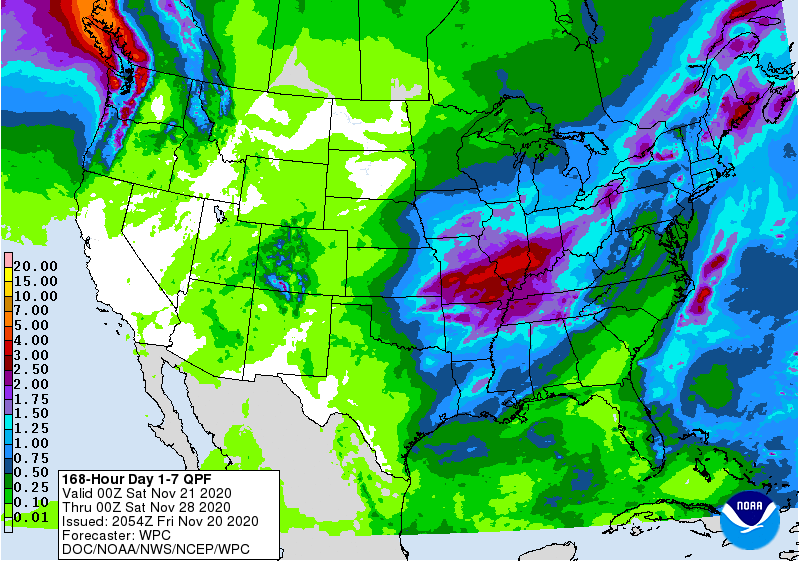
Here is the outlook from the Weather Prediction Center through the end of the next week but it appears they are discounting any late week system....
The possible system towards the end of the next week may or may not be that significant. I say that because being a week out in the pattern like this it is virtually impossible to predict the time, space and intensity. But, just know that there "could be" an amplified system.
As far as the returning systems I discussed in the previous post, I just don't know yet what that repeating cycle length is or will be. I have a hunch that it is between 50 and 60 days.
If I don't have an opportunity to update this blog next Wednesday (25th), then I won't get to it until around the 1st.
No comments:
Post a Comment