Wednesday, November 25, 2020

A Precipitation event! Updated 11/25/20

 In the previous post on the 20th (read it here) I discussed the system that would occur on the 21st and said "In general, amounts will be a quarter of an inch or less.  But there will be bands of precipitation (relatively small) where some will get closer to 1/2 to 3/4 of an inch."  Here is what fell....


Just that one storm is encouraging going forward as it will return later this winter and spring.  

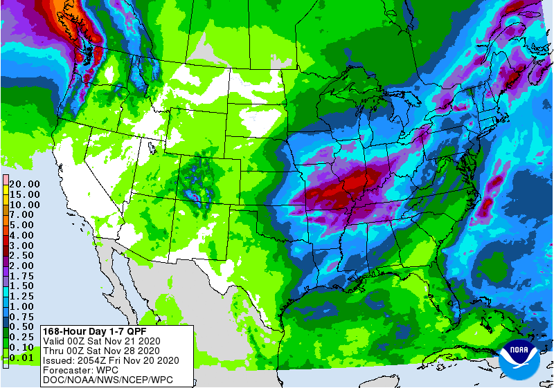
The next system I discussed was to occur Monday with another possible later in the week, based on energy across the Pacific.  It appeared the first system would impact mainly Nebraska and the eastern half of Kansas.  As has been the case with a couple of the systems this fall, the first one amplified way more than expected and thus slowed down.  The precipitation occurred yesterday and was MUCH more than expected! This is yet another encouraging sign!  However, what is still very concerning is that the hardest hit drought area keeps missing out on the heavier precipitation.    Here is a map of the precipitation that occurred yesterday with this storm....


There were reports of over 2 inches of rain across parts of Saline county and up in to north central or northeast Kansas.  And, for the second time this month, there was a lot of lightning and thunder.  That is unusual for November.

Because the upper level low was so compact and energetic it was capable of producing an area of snow.  However, the area was very small compared to the area of precipitation that it produced.  A cold source really was not available (colder yes, but not snow-like).  But, it still produced the snow!  The largest amount I saw was 6 inches with numerous reports of 2 to 4 inches...lesser on the edge of the snowfield. 


So, as I've mentioned a zillion times.  The weather pattern of upper level troughs and ridges and orientation of the jet stream will start to repeat or have very similar characteristics.  I still haven't seen evidence of this repeating but it has got to be getting close.  The pattern started setting up that first week of October and I'm going to say centered on October 7.   Looking ahead I suspect that mid-December ought to get really interesting based on a hunch, thinking the wavelength is around 55 days give or take.

Later this weekend or first of the week there should be another system but at this point it looks like it will stay way south across Texas.  Long range computer models are getting screwy late next week and I think that might be related to an active jet stream across the Pacific.  All bets are off beyond about 5 days.  

I'll try and update around the 1st.

Friday, November 20, 2020

Brief update - 11/20/20

This will have to be brief.  In the last update on the 13th (read it by clicking here) I ended with "There is enough energy across the Pacific Ocean basin that I see a possibility of another amplified system centered around the 21st.  That might be our next shot at precipitation (20th, 21st, 22nd).  Before that, much warmer weather is expected next week."

At this point all is on track.  It was definitely warmer!  In fact, temperatures were 15 to 20 degrees above normal!  That is pretty significant!  The precipitation event expected does look like it will be primarily tomorrow (Saturday the 21st).  In general, amounts will be a quarter of an inch or less.  But there will be bands of precipitation (relatively small) where some will get closer to 1/2 to 3/4 of an inch.  The rain will be widespread and maybe as far west as the Colorado border but again it won't be much.  

The Pacific jetstream moving into the Conus is energetic and there should be a few more systems by Monday and perhaps again later in the week.  The first one will bring the majority of the precipitation to Nebraska, Iowa and the eastern half of Kansas with just widely scattered "stuff" to western Kansas.  Neither system (Saturday and Monday) will do much to alleviate the worsening drought.  

Here is the outlook from the Weather Prediction Center through the end of the next week but it appears they are discounting any late week system....


The possible system towards the end of the next week may or may not be that significant.  I say that because being a week out in the pattern like this it is virtually impossible to predict the time, space and intensity.  But, just know that there "could be" an amplified system.  

As far as the returning systems I discussed in the previous post, I just don't know yet what that repeating cycle length is or will be.  I have a hunch that it is between 50 and 60 days. 

If I don't have an opportunity to update this blog next Wednesday (25th), then I won't get to it until around the 1st.


Friday, November 13, 2020

Update - November 13, 2020

 Sigh...

I had attended to post an update last week.  But, I had to change out laptops and lost a lot of data links and programs I use to keep up on the weather.  Most have been restored.

The most recent precipitation event on November 9th was a bit of a surprise,.. at least it was not expected 3 or 4 days out.  It originally had looked like the system would be too fast and not amplified enough to bring precipitation to areas west of southeast Kansas.  As it turned out, the system amplified into a closed low over the 4 corners region and was then capable of drawing moisture north from the Gulf of Mexico.  Unfortunately for areas hardest hit by the drought very little or no rain fell.  Here is a map of precipitation for the event....


At several locations there was even severe sized hail (1 to 1 1/4 inch in diameter).  So, the system was very energetic.  In this new northern hemispheric weather pattern that developed in early October, this is the second time a strong upper low amplified across the west and benefited at least a big chunk of the central U.S..  Yes, farther west there hasn't been that much.  That IS a concern.  But at the same time, I'm slightly encouraged that there have been these 2 events.  

So going forward into winter and next spring, these 2 episodes will return.  More than likely they will be impacting events (blizzards for the cold season and severe weather in the warm season).  However, what still has me concerned is that there will likely be long stretches of no precipitation going into spring.  Those periods may also be associated with above normal temperatures and lots of wind.  That's not a good combination. 

In the previous post I did on the 29th of October (read it by clicking here) I mentioned November 10-15 being a suspicious period that models were converging on that could bring some weather.  Unfortunately, there just isn't enough amplification of the jetstream to bring precipitation for the high plains.  It looks like southeast Kansas will be as far northwest as we can expect with this one.  Just more wind and warmer weather for the high plains.  Here is the outlook from the Weather Prediction Center through the end of next week....


No help for the drought area....

U.S. Drought map

So, as I've mentioned way too many times, the weather pattern that forms in early fall will begin to cycle at some point.  I don't know if that will be every 30, 40, 50, 60 days, etc. until I see the whites of it's eyes (I can recognize similarities across the northern hemisphere).  There is enough energy across the Pacific Ocean basin that I see a possibility of another amplified system centered around the 21st.  That might be our next shot at precipitation (20th, 21st, 22nd).  Before that, much warmer weather is expected next week.  

I'll try and update later next week.