Saturday, February 23, 2019

Update 02/23/19

In the previous post (you can read it by clicking here), I discussed the active period of cold and occasional storms that would last into at least the first week of March.  The current (as of Saturday morning the 23rd) storm will end up being very impactful.  I had done several climate/weather presentations this past week and mentioned this one as the storm to watch as blizzard conditions would occur.  BTW, this is the same storm that dumped snow on parts of LA, Las Vegas and 3 feet on Flagstaff.  For details on the current situation, follow weather.gov for the latest.

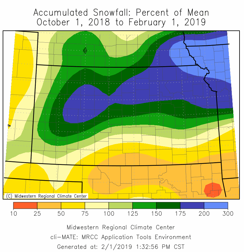
The amazing moisture profile across Kansas will continue to build with this storm.  Yes, I understand that it will actually be too much at some locations.  It will also continue the struggles with the cattle feeders with the muddy (and snowy) pens.  At this point I don't see much relief in sight.  Farther south across the TX panhandle and west Texas, it's a different  story.

Here is the latest US Drought monitor map....


I've discussed the dry area expanding across west Texas during this past few months.  As I've discussed in presentations I've been doing, it could be a concern going into Spring - but there should also be opportunities for this area to improve moisture wise.  Here is the outlook from the Climate Prediction Center valid through the end of May...


Often in west Texas, very dry conditions tends to promote spring dry lines to advance farther east during the spring - which in turns decreases precipitation opportunities west of the 100th meridian.  But, again, I see some opportunities for that area to pick up moisture as spring approaches.  More on that in later posts.

Looking at this mornings satellite image....


The current storm is the red L (the upper storm) that was across the northern Texas Panhandle.  That storm will quickly move into the mid-west.  That track BTW, will continue dumping moisture on much of the corn belt.  There is currently an upper level ridge that extends well north which is still set to bring more cold air into the central U.S..  As I've mentioned in the previous posts, the active weather with cold continuing into March will continue.  One reason - the MJO!

Here is the latest position of the current MJO and it's forecast.


As I've discussed in the blog and in the presentations I've been doing, this MJO will be propagating through an area of the tropics that typically enhances below normal temperatures and above normal precipitation for the high plains.  That is ONLY if the MJO is forcing the pattern, which at this point I think it has been a big factor this winter.  Here is a composite of what typically occurs across the states as MJO's move towards the Indian Ocean during February....


So, back to the MJO current location and forecast.  If it continues to hold and move into what is called phase space 1 and 2 and is "calling the shots", I would continue my thoughts of below normal temperatures going into the first week of March.  That doesn't mean that a day or two moderates to above normal temperatures.  Just that overall it will be colder than normal.  Also, there will continue to be opportunities for moisture - meaning the odds would favor at least normal to above normal precipitation.

Overall March should be very active across the high plains.  In fact, I think the odds of an Arctic intrusion of very cold is fairly likely by the 1st.  During the month I would expect another blizzard, severe weather, a day or two of warm and windy, etc.  In other words, a typical March.  

I'll try and update again next week.

Wednesday, February 13, 2019

Quick update - 2/13/19


In the previous post I did on the 1st, (you can read it by clicking here), I mentioned several things I want to discuss.

1) The MJO (Madden Julian Oscillation).

The remnants of the decaying MJO is providing a HUGE swath of Pacific moisture streaming northeast from deep in the tropics.  That can been seen in the satellite image from this morning (white stretching from the bottom center of the image to the southwest U.S.) and this will be a player for a while. 


2) I had a hunch of a February 13th storm (day or two either side) that I had expected for a LONG time.

It looks like that system may be what comes through the central U.S. late Thursday and Friday.  It won't be a huge storm but it will drop pretty cold air and that will set the stage for the next series of storms. There will also be a swath of snow somewhere across Kansas but since it's not quite on the coast, details are uncertain (most likely the norther half). Just check the latest weather.gov forecasts for details.

3) Expecting an active period going into March.

This certainly appears to be panning out.  The jetstream across the Pacific and combined with the southern branch of the westerlies (that band of moisture pointed towards the southwest U.S.) will play a major role in what is to come.  Also, brutally cold air across Siberia and into Canada will make a run towards the U.S.. But, even though the center of the airmass won't make it into the states, the expanse of the cold air will allow for much below normal temperatures for the high plains for the balance of February (after Thursday) that will periodically last into the first week of March.

Several strong upper level systems will be moving across the central U.S., but details of where, when and magnitude of the impacts are not forecastable this far out.  But, I do expect much of the high plains to be covered in snow once we get past Thursday (14th).

Here is the latest precipitation map from the Weather Prediction Center through the 20th.  I do expect this to change going forward.


I'll attempt another update this weekend.  Just be prepared for a cold stretch with occasional snow, that may eventually add up to quite a bit.

Friday, February 1, 2019

Update - February 1, 2019

This past few weeks has been pretty active, especially for areas north and east of the high plains of the Kansas area.   The brutal cold that centered on the midwest/Great Lakes was a doozy and record breaking for "some" areas.  I puke every time I see posts (media and social media) that the Polar Vortex was fully responsible and act like it's never happened before. I've discussed this before in this blog.  The "polar vortex" is present all the time and it's southward intrusion into the U.S. happens on occasion.  It's most prominent during the winter.  THIS IS NOTHING NEW!  Good lord!

In the previous post I did on the 13th, I was expecting this cold.  But I also was expecting it to be a little farther west bringing a pretty good possibility of below zero readings to the high plains.  Instead, the sub-zero readings were as far west as eastern Kansas.  I did mention below normal temperatures for the high plains for the period January 21-31 and indeed that did happen.  For example, here is what Dodge City observed....                                                                    


I've heard from quite a few folks about the mess in the feedlots across much of western Kansas.  With so much moisture since the fall and without a lengthy drying period, the pens are full of muck that can't be cleaned up much without really cold weather.  Here is a look at the percent of normal of what has fallen since October 1, 2018...


Without checking, I bet for this time of year this has to be in a top 10 for record keeping.  If I get some time, I might check into.  Regardless, it's been really wet with many areas over 3x the climate  normal.

Back in the early Fall, the outlook I gave was for the winter to be near to below normal on temperatures and above normal precipitation, including so.  So far (Dec-Jan) it's been a little warmer on average. 


Snowfall/precipitation has been above to much above average and many locations (while conversely snowfall has lacked in other areas where it was rain and not snow during the weather events).


With the continued wetness, the long term drought map does not show any area of Kansas in a drought.


So what's next?

The pattern is changing again.  The brutal cold that is gripping the midwest is lifting out and moving east as the jetstream will undergo a transition from northwest to southeast to southwest to northeast with time.

Looking at the latest satellite image from this Friday afternoon....


There was a decent storm headed towards the west coast.  This system will weaken once it gets past the Rockies late this weekend.  But before that happens, it will dump feet of snow on the high country of Colorado.  Also, it will cause a surface response across the high plains where much warmer air will result, and unfortunately temporarily increase the wildfire danger. 

Once this system moves by, cold air will drop in behind it for the first of the week.  The second system (red X on the satellite image above) will approach the central U.S. by mid-week (~6th).  Many uncertainties exist for that system since it's many days out.  Much of the high plains should be well into the cold air .  Precipitation would most likely snow or freezing rain.  Specific details are not forecastable with any degree of accuracy at this point but it might be a system that will cause impacts.

Beyond the mid-week system, I continue to expect an active pattern for February and into early March.  A day or two either side of February 13 is one target date but with low confidence.  In addition, more outbreaks of very cold air can be expected this month and this time centered farther west.  I'm pretty confident that precipitation will be above average for February and temperatures below normal causing more impacts to the cattle industry on the plains.

Later, from mid-March and into April we could very possibly have what I call a "false spring" and then get greeted with a late April/early May punch in the gut. I'll discuss that later this winter.

I'll try and update again sometime next week.