In the post I did on 5/20 (read it by clicking here), I discussed the upcoming week that was expected to be very active with an extended period of severe weather. Unfortunately, that did come to pass.
As far as rainfall, some areas got a lot, some areas not much at all. The following map shows the approximate rainfall that fell during May (click for a larger map)....

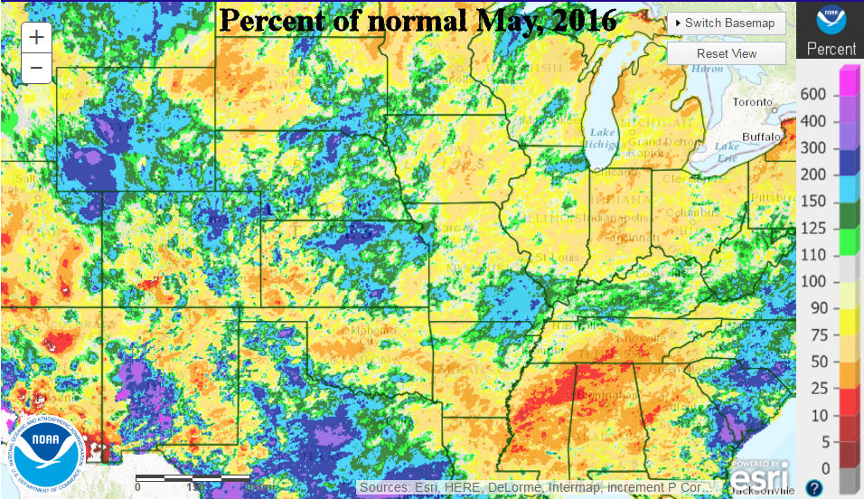
Unfortunately, there were quite a few areas that were very dry for May. But, they were also the same areas (in general) that received copious rains during April.
The percent of normal map follows: (again click for a larger map)
Although there were areas that didn't get much rain at all, other locations received TOO much rain!
I wish I had more time on my hand to evaluate this pattern. For the next 10 days, there the pattern is definitely drying out for those that have been getting rains. Here is the outlook potential rainfall through June 10 (this is a computer generated forecast)....

The Weather Prediction Center has a similar forecast through the end of the weekend (7 days).

Even though I haven't had time to analyze much, I still think (from earlier assessments in May) that the period from June 10-20 may become somewhat active which increasing chances for moisture.
I'm not sure I'll have a chance to update this blog before next week.
No comments:
Post a Comment