Also, please visit the previous post if you have not already done so by clicking here.
I'll start this post by showing the precipitation that fell during the previous 7 days (actually from 8/27 through 9/2).

As has been typical for a while, some areas got excessive rainfall while others missed out on getting good rains.
An update to the current drought...


Looking at the precipitation deficit/surplus at the Dodge City airport...we are doing pretty good for this Wateryear (2014 which started Oct 1, 2013). But the longer term going back to October 1, 2010 is not as rosy but continues to improve.


The satellite image from 9/3 shows several interesting and big "play makers".
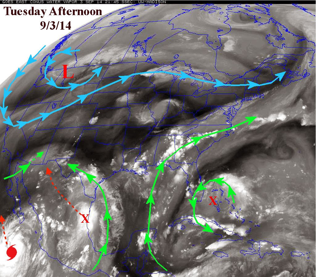
First there is that low up across western Montana. The associated jet stream is taking quite a dip into the northwest part of the country. This will ultimately deliver some rather chilly air into the Conus, including southwest Kansas. Low temperatures this week will fall well into the 40s across the northern plains and even well into the 50s across Kansas. This will further delay the maturing sorghum and corn. This HAS to be of concern, right?
The other features that will impact Kansas is the X across Mexico (depicted in the above map) which will help deliver energy and moisture in the southwest U.S. and even into the panhandles of Texas and Oklahoma, which a glancing blow to southwest Kansas. The other will be remnants of the hurricane moving towards extreme southern California. The result will be copious amounts of rainfall across the southwest deserts and into Texas and Oklahoma and eventually across the corn belt. The following map is the 7 day estimate of potential rainfall courtesy of the Weather Prediction Center.

I will be doing a fall and winter outlook soon, at least by September 23-24. In the meantime, there is still NO El Nino, but it is steadily looking like one will develop late this fall and winter. That would have at least a bit of an impact on sensible weather. More later....
The following map shows the Southern Oscillation Index - the trend strongly in the negative for an extended period indicates an El Nino.

No comments:
Post a Comment