In the previous post on the 17th, and it was a long one, I discussed a potential significant storm centered on December 27, give or take a day or two. There was a lot of information in that post and you can read it here. Ten days away and I put that date out there. At the time there were NO computer forecast models with anything at all through the end of the year. As late as 21st there was a lot of social media from various folks discussing above normal temperatures and below normal precipitation with NO storms through the end of December. I was patiently waiting for those computer models (and the forecasters) to finally pick up on the possibility. So, here we are on the 24th and I'm sure a lot of you have already heard the chatter about a significant storm next week. Is it a slam dunk at this point? No, not yet because of the complexity of what is going on with the jet stream, especially across the Pacific.
Here is a snapshot of the atmosphere late this afternoon....
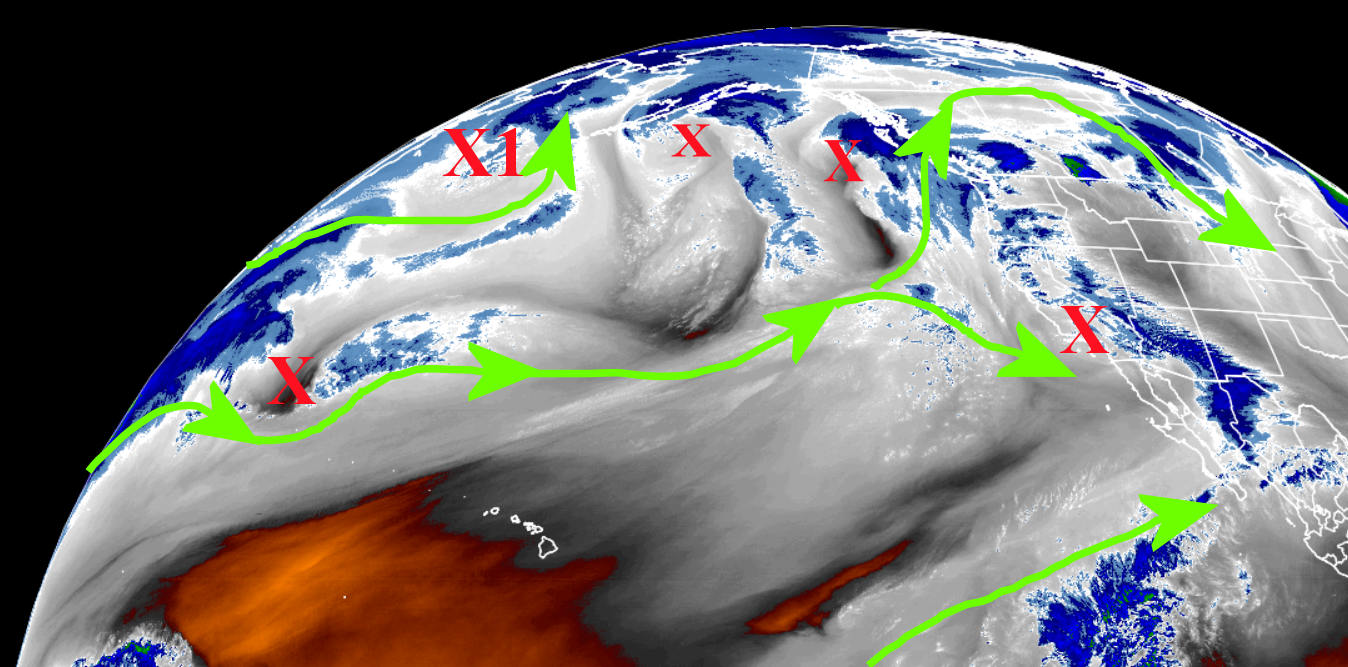
The winds aloft across the Pacific are active and very complicated. There are several source regions for energy, both tropical, mid-latitude, and higher latitude influences. The red X's are disturbances (or storms) aloft with varying intensities. The one that has my attention I labeled X1 near the Aleutian island chain of Alaska. This disturbance in the wind field "should" begin to amplify as it approaches the west coast. If not, there may be another development. Regardless, amplification of the wind field should occur across the western U.S. starting late in the weekend and the result will be a widespread precipitation event for the central U.S., including much of the plains.
What makes a forecast with any detail impossible at this point is that it is uncertain which disturbance will become the main storm. How amplified will it be? What track will it take? Exactly when does it move across the plains? How cold will the airmass be? Will it be cold enough to support all snow? Freezing rain? Sleet? Thunderstorms? Wow, there are MANY possibilities! At this point, it's best to follow weather.gov as we get closer to the event. You will see many computer solutions on social media, and THAT I can be certain about. Some of these computer model solutions I've seen have ridiculous amounts of precipitation. Some solutions (from the American model) keep much of the high plains dry while others are very wet.
As for that date of the 27th that I mentioned in that blog posting on the 17th...it looks like there could already be a little freezing drizzle as early as late on the 27th although the main "show" will probably be later on the 28th into the 29th.
Here is an "early guess" from the Weather Prediction Center on precipitation amounts incorporating this potential storm. At this point, it's just a broad brush of possible amounts. Again, details are not possible at this point.

If I get a bit of time, I may try and update this blog late Sunday or early Monday.
No comments:
Post a Comment