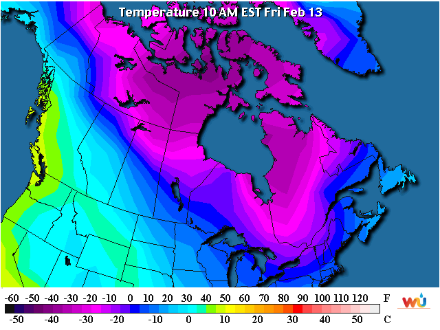
Looking at this mornings temperature map the notable cold has shifted east across Canada. The signal really doesn't support the cold into Kansas, yet. Initially what will happen is the cold front that moves in tonight and early tomorrow will bring colder air in from the east. Thus, eastern Kansas will be colder than the high plains. (click for a larger version)
Before I go into more currents and the extended, I thought I would share a graph of the ridiculously mild temperatures we had in Dodge City centered on last weekend. Although it wasn't the warmest stretch for the winter months (for Dodge), it was certainly significant. It's interesting that in the record books all these long and mild stretches occurred in February.

Currently
Looking at the morning satellite of the western U.S. and eastern Pacific, there are several important features.

The first feature is the "L" over the Baja of California. This is the system I discussed in the previous blog that was to bring a little precipitation to Colorado and near the high plains. It dropped south through Colorado and now moving southwest to the current position. It brought pretty good snow and rain and even a little rain into west Texas and the Panhandle. I don't think this will impact Kansas now that it is were it is.
Another feature is the X headed towards the Pacific Northwest which will help bring in a second front on Monday. Precipitation with that feature should be confined to Colorado but with a second area forming across eastern Kansas and into the Tennessee valley.
The other significant feature is the "L" that is denoted on the left hand side of the image. This Low and trough aloft will help pump up of the jetstream and ridge that will eventually unleash some really cold air into the states later next week (and could help bring a day of milder air to the high plains).
Now some of this cold air may initially be modified because of a lack of snow cover across the northern plains.

But with each system some of that bare ground will get a dusting. The following map is the expected snowfall expected through Monday morning.

Beyond the first of the week the pattern will become complicated and hard to pinpoint. There will be a chance for a least light snow across the plains, but with some amplification there just might be a more significant storm. I would not expect that possibility until late next week.
Looking a little further, this cold and unsettled weather may linger into the end of the month.
More next week.
No comments:
Post a Comment