In the previous post I did on the 12th (read it here), I discussed the upcoming weather system. So far it's developing as advertised. BUT (yep, there is that "but" word) there is still a lot of uncertainty of amounts and where the heavier rain will fall! In the previous post, this is what I said
"Will all areas receive this much? NO! But, it is possible many locations will. In general I would feel confident of widespread 1 to 2 inches."
Let me start with the afternoon satellite image....

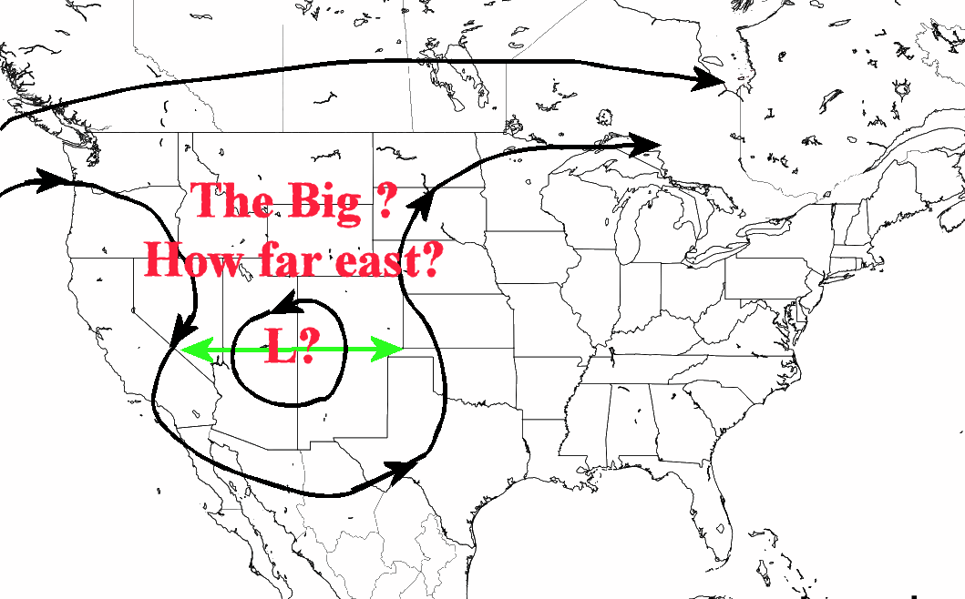
The upper system is developing as advertised but it is in the initial stages of development. The X1 on the map near Las Vegas, NV should become the dominant system as it deepens and breaks off from the jet stream across Canada. The X2 appears to be dropping south and should merge with the other system to form into an intense upper level low. Gulf of Mexico moisture is somewhat lacking at the moment because of the departing system that over eastern Arkansas. But, gulf moisture should become plentiful.
Computer models have been ALL over the place as far as location of heavier rain. One run it's near the Colorado/Kansas border, then the next over central Kansas (for our local area). One issue will be just how far east or west the upper low gets. This will have an impact of where heavier rain sets up. The location is just simply unknown and impossible to predict at this point.
 Then, there will be mesoscale processes (small scale features) that will also impact locations of heavier rain. There is a very high confidence that excessive rainfall will fall, but the exact location is just impossible to predict because of the large scale and mesoscale processes. If I pick just one location, let's say Dodge City for instance, the actual possibilities of the amount of rain through Tuesday would range from as little as 0.50" to as much as 6 inches. That is a HUGE spread but it's the honest truth and just the way it is! I'll go back to my original statement from the post on the 12th. I'd feel confident of widespread 1 to 2 inches across much of the plains.
Here is the latest outlook from the Weather Prediction Center (again, don't count on the amounts at any one location, just consider this to be a high end possibility) through the end of next week. Adjustments will be made with the small scale interactions....

No comments:
Post a Comment