The latest water vapor imagery below shows a kink in the tropical jet stream (denoted by the L). This system has tropical origins and thus has already helped to generate very heavy rain across southern Wyoming and Colorado this afternoon and evening. As of 900 PM rainfall up to 8 inches has fallen near Eads in east central Colorado.

The setup is just right for a band of excessive rainfall from Colorado into Oklahoma. The excessive rainfall may be narrow in width but some areas from west central Kansas and southeast into Oklahoma will receive over 5 inches of rain from this system tonight and Wednesday. It is still a little unclear where to pin point this but the heavier rain could end up anywhere from Garden City to Liberal and maybe near Dodge City, Meade and Ashland. Everyone across the western half of Kansas will get at least some rainfall. The latest radar as of 925 PM CDT shows an expanding area of thunderstorms with heavy rain over Colorado and far western Kansas with "feeder bands" extending into northwest and central Kansas. This area was moving east and southeast.

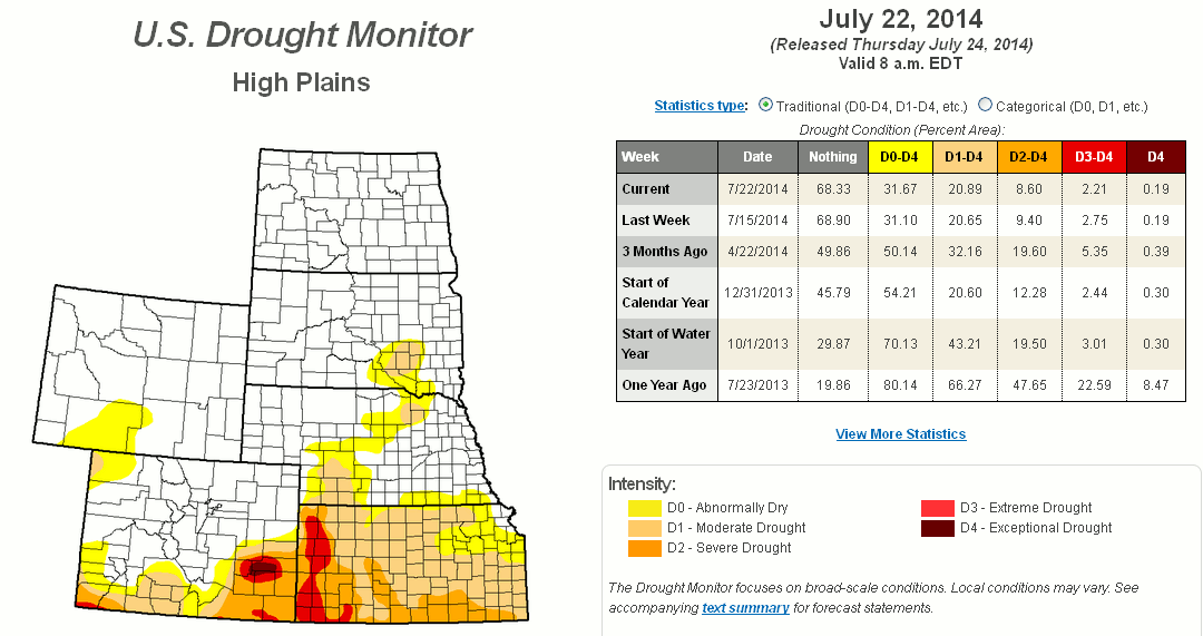
When I get back from my trip (or I might get to it Wednesday morning before I leave) I will give an in depth view of the improving drought situation. As it stands from the 22nd there continues to be improvement on the long term situation. More later....
No comments:
Post a Comment