As advertised in the last blog post on the 9th (click here) the advertised cold weather has continued (except for a few brief days of "mild") temperatures. The 2 and 4 inch soil temperatures plummeted to below climatological normals this past week. From the Kansas State Mesonet here is a look at the 7 day average 2 and 4 inch soil temperatures around Kansas (as of Monday afternoon the 19th)....
The precipitation this last 7 days was not nearly as significant as I first believed would be possible. The most widespread shot of precipitation was late on the 16th into the 17th. There were some decent amounts but what is concerning is the void area across the southwest counties of Kansas. Here is a look at the precipitation the past 7 days ending this Monday morning (April 19)...
I DON'T like the configuration of the missed area! During the winter I in the back of my mind I was "thinking" about shades of 2011. Then with the posting I did on March 5th I mentioned it again. I'm still not sold on that yet but concern is increasing. More later.
With the posting I did on the 5th of March I also mentioned the period of April 17-20 and in the warm sector there would be the threat of severe weather and the potential for a blizzard in the cold sector. Although I'm not expecting a blizzard tomorrow (20th), there will be definitely be widespread snow of varying amounts (accumulations). Here is just a really quick though from the Weather Prediction Center...
The biggest issue will be the potential detrimental cold expected. Here is a look at expected minimum temperatures the next 48 hours (and adjustments will be made by the National Weather Service - these are just first guesses by the agency)...
For Tuesday morning (and unfortunately there will be wind with these temperatures)....
For Wednesday morning (less wind)....
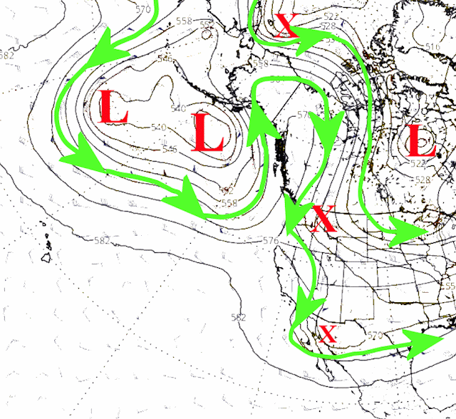
The cold air is the result of the same configuration in the jetstream that I discussed in that last post on the 9th. Compare this upper air chart from this morning to what I posted on that date. It's very similar with the configuration across western Canada.
Later in the week there is signs of a weak system passing across Oklahoma that "might" bring a little bit of precipitation to parts of the high plains (more likely for eastern Kansas though) on Friday. I wouldn't get too excited at this point.
Here is the outlook for precipitation through next Monday with the majority of what you see for the central plains occurring with the snow...
For this past few months I discussed the period of April 25th through May 2. The most likely impact would be colder weather (again). There continues to be a hint of that happening. I think once we get past the 2nd, there should be a dramatic and pro-longed warmup. I'll try and update that possibility in the next post (shooting for 23rd).
And just in case if you haven't had an opportunity to help me out filling out a very brief, short survey...here is that link: https://www.surveymonkey.com/r/7ZSGTTG


No comments:
Post a Comment